 |
These photographs enlarge to either of two sizes. Click
on the left half of any thumbnail picture to enlarge to about
400 pixels wide, click on the right side to enlarge to 800 pixels
wide.
<Left Column
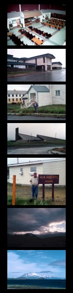
- BRHS Cafeteria (Bob Reeve High School)
- BRHS Entrance (Bob Reeve High School)
- Northwest entrance (back door) of the Old Church on Bering
Hill.
- Looking southwest at the New Church on Bering Hill.
- New Roberts housing.
- Excellent Weather -- a bit of sky is visible.
Right Column>
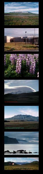
- Mount Moffett, view to northwest from a point near the south
end of the runway.
- Let's not forget the Navfac folks -- here's where you once
worked.
- Lupine
- A lens cloud formed over Mount Moffett.
- Mount Adagdak from the south. Clam Lagoon can be seen on
the right.
- A wonderful telephoto shot westward from Horseshoe Bay. Kanaga
Volcano is in the distance, it might be possible to make out
Tanaga in the far distance at the far right, and Mount Moffett
is the large dark cliff in the near distance.
- A view north through the small valley between Mount Adagdak
on the right and whatever it is called on the left. A dirt (mud)
road proceeds through this valley enroute to the LORAN station
and Horseshoe Bay.
|
 |
 *
* 