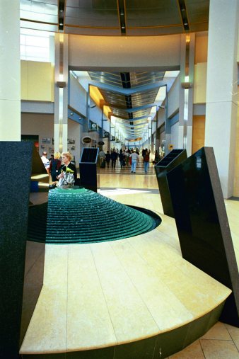
That was then; this is now -- very elegant, concourses that conduct you right from your seat on the aircraft, past artistic sculptures, kinetic art, tapestries; shopping -- and you are still in the airport! I particularly like the flowing water sculptures, the one at the upper left flows water over a series of concentric disks, each larger than the one above, and the whole thing is ringed about by a rather science-fiction looking series of buttresses, and above it, the skylight window is round and suspended below the skylight a big shining golden ball. No, I have no idea what it "means" but it is certainly impressive.
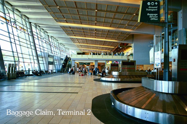
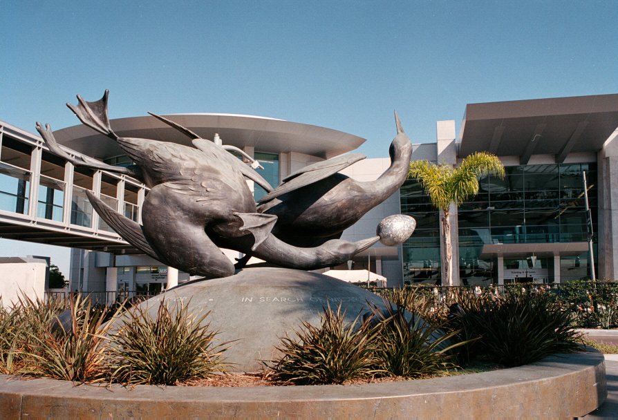
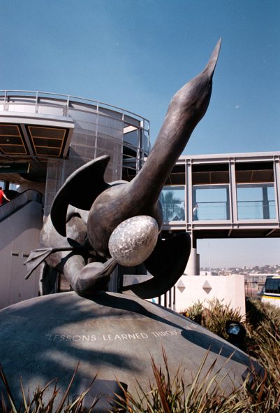
Once you have retrieved your baggage, you will very likely go back up the escalator, cross the skybridge, and down to the waiting area for the rental car shuttle buses. While waiting for a suitable shuttle bus, examine the fascinating sculpture (photos on right) and contemplate its meaning. Anyway, the main difference among rental car companies is no longer who has the rental booth nearest the baggage claim, but how often their shuttle bus arrives -- which translates into how long you might wait for your car (arriving) and how much time before your departing flight you should return the car. I suspect that most of the rental facilities are on the Do allow plenty of time when returning to the airport. I used Alamo rental cars, the service was quick and professional, but finding the return place can be quite challenging.

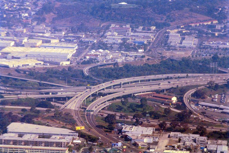

Alamo's rental facility is on Palm, near Pacific Highway and adjacent to Kettner which runs parallel to Interstate 5. Budget Rent-A-Car is also located nearby, right on Pacific Highway. As such, if you time it right, you can be on the freeway in less than two blocks from the time you leave either. But to do so, go up Palm, turn right on Kettner -- but wait! Don't do it until you can cross all three lanes and get into the left lane, 'cause you have only one block to get into the left lane for the on-ramp. If you miss it, go six more blocks to GRAPE, turn left and go two blocks and watch for the onramp. Either way, once on I-5 you experience a roller-coaster ride of ramps, lamps, signed spots and blind spots, on ramps and off ramps and ramps that aren't completed yet and which would give you a brief but thrilling airborne ride at 70 miles per hour if you made a mistake. Yes, it is fun, but no time to be looking at maps. I have discovered an excellent online resource for maps, which show sufficient detail to see the loops of the freeway interchanges. One of the Mapquest maps is shown at the left, enhanced a bit to show where I made the photographs that appear at the right.
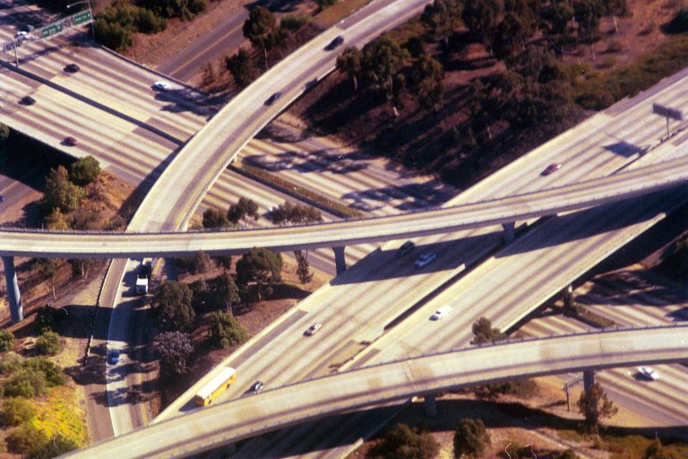
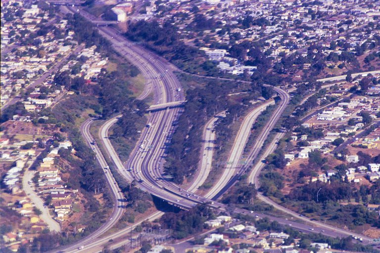
![]() At the upper left is where I-8
intersects I-5 near Sea World, the view is to the
northeast. Below it is a rather fuzzy aerial view of Sea
World, conveniently located at the western end of I-8.
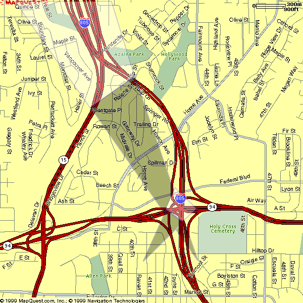
Bottom left is a Mapquest map which helps locate the two
photographs at the right. I have added highlighted areas
that correspond to the photographs at the right, and the
dark triangles represent where the aircraft was located
when I made the photograph. At the upper right is I-805
(from upper left to lower right, going south) crossing
under I-94, shown on the locator map at the top.. Below
right is I-805 coming southward from the upper left,
crossing I-15 coming from the upper right. As you can
see, huge and complicated freeway-to-freeway interchanges
sometimes happen one right after the other!
At the upper left is where I-8
intersects I-5 near Sea World, the view is to the
northeast. Below it is a rather fuzzy aerial view of Sea
World, conveniently located at the western end of I-8.
Bottom left is a Mapquest map which helps locate the two
photographs at the right. I have added highlighted areas
that correspond to the photographs at the right, and the
dark triangles represent where the aircraft was located
when I made the photograph. At the upper right is I-805
(from upper left to lower right, going south) crossing
under I-94, shown on the locator map at the top.. Below
right is I-805 coming southward from the upper left,
crossing I-15 coming from the upper right. As you can
see, huge and complicated freeway-to-freeway interchanges
sometimes happen one right after the other!
Lucky for me I was using GPS to help navigate. I have found the MAPQUEST maps to be the most accurate of the online maps, but you will need any of several CD-ROM products to obtain the latitude/longitude for your destination (apartment complexes listed on http://www.isyourhome.com all have GPS coordinates included for your convenience in locating these properties).